

Travel guide
How to get to Erg Chigaga: two pistes, one rule
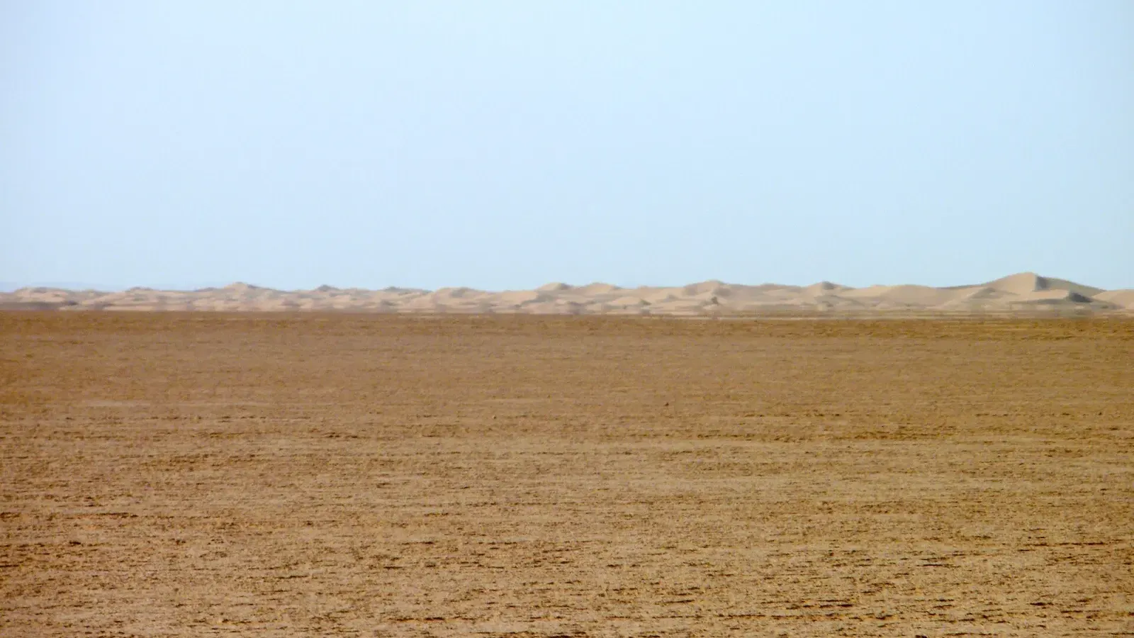
Photo: Angela Stefanoni / Panoramio via Wikimedia Commons, CC BY 3.0
How to get to Erg Chigaga comes down to one fact: the tarmac stops 50 km or more short of the dunes. You drive, or take a bus, to M’hamid El Ghizlane in the east or Foum Zguid in the west, and then cover the last stretch on a desert piste in a 4x4 or, if you have three days, on a camel. This guide compares the two routes, gives drive times from Marrakech, Ouarzazate, Zagora and Agadir, and is straight with you about driving it yourself.
How to get to Erg Chigaga: the two routes at a glance
| Via M’hamid (east) | Via Foum Zguid (west) | |
|---|---|---|
| Paved road to | M’hamid El Ghizlane, end of the N9 | Foum Zguid, on the N12 |
| Piste to the dunes | about 50 to 60 km | about 60 to 100 km |
| Time on the piste | about 1.5 to 3 hours | about 2.5 to 3 hours (up to 3.5 with a stop at the lake) |
| Terrain | stony hamada, soft sand, dry lake beds | stony plain, dry bed of Lake Iriki, soft sand near the erg |
| Best for | most camp transfers, trips from Zagora | trips from Agadir, loops that cross the whole park |
Many tours combine them: in from one side, out the other. The full crossing from Foum Zguid to M’hamid takes 5 to 6 hours of driving, according to the Souss-Massa regional tourism board, and riders on the Horizons Unlimited forum log it at around 145 to 151 km.
Route 1: the M’hamid piste
This is the classic way in, and the one most camps use for transfers. From Zagora, the N9 runs about 95 km south to M’hamid El Ghizlane, a drive of roughly 1 h 45 to 2 hours on tarmac. The road ends in the village.
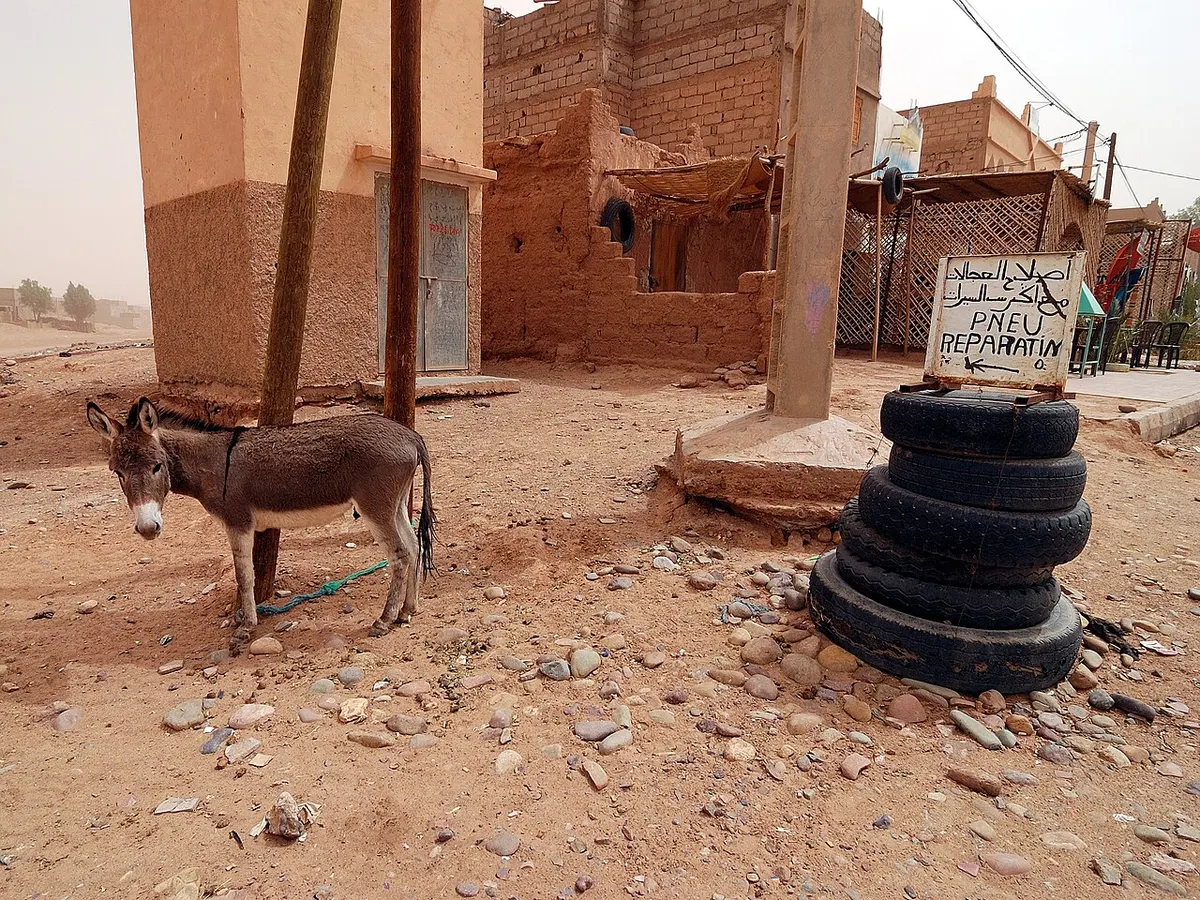
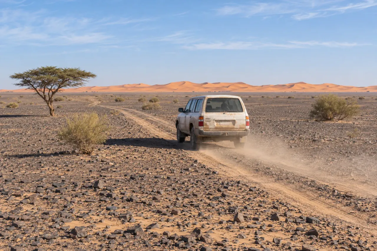
From there the piste heads west for about 50 to 60 km. Wikipedia and Lonely Planet both put the heart of the erg about 56 km south-west of M’hamid. The surface changes every few kilometres: stony hamada that punishes tyres, sandy patches of powdery fech-fech, and dry lake beds that can hide mud after rain. Time estimates vary with the driver and the camp. Lonely Planet France says under 2 hours, Le Petit Journal about 2 hours, Dangerous Roads 2 to 3 hours.
If you have the time, the same route can be done on a camel. Lonely Planet France describes it as a trip of about three days.
Route 2: from Foum Zguid via Lake Iriki
Foum Zguid is a small oasis town on the N12, about 150 km south of Ouarzazate via Tazenakht. From here a track heads south-east across Iriqui National Park. It crosses the vast, usually dry bed of Lake Iriki before reaching the western dunes after roughly 60 to 100 km, depending on where your camp is. Tour operators give about 2.5 hours and Lonely Planet France about 3 hours; allow up to 3.5 hours if you stop at the lake.
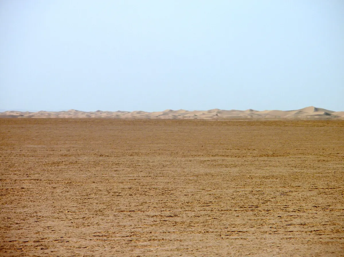
The lake is the part to watch. The Souss-Massa tourism board warns that after the wet months, roughly October to December, the lakebed can turn muddy and trap vehicles, and it states plainly that a 4x4 is mandatory for this crossing. Forum reports from riders also describe deep, soft sand between the lake and the erg. In a normal dry year the lakebed is hard and flat, and the drive across it is one of the emptiest landscapes you will see in Morocco.
Drive times: Erg Chigaga from Marrakech and other cities
The table shows road distance and driving time to each gateway town, without stops. Figures are ranges from Rome2rio and OSRM (OpenStreetMap routing), checked in November 2026. Add the piste time from the section above.
| From | Gateway | Road distance | Driving time to gateway | Then piste |
|---|---|---|---|---|
| Marrakech | M’hamid | 446 to 448 km | 7 h 40 to 8 h 40 | 1.5 to 3 h |
| Marrakech | Foum Zguid | 311 to 317 km | 5 h to 5 h 45 | 2.5 to 3 h |
| Ouarzazate | M’hamid | 252 to 260 km | 4 h 25 to 5 h | 1.5 to 3 h |
| Ouarzazate | Foum Zguid | about 150 km | 2 h 40 to 3 h | 2.5 to 3 h |
| Zagora | M’hamid | about 95 km | 1 h 45 to 2 h | 1.5 to 3 h |
| Agadir | Foum Zguid | 353 to 356 km | 4 h 50 to 5 h 30 | 2.5 to 3 h |
| Agadir | M’hamid | 541 to 564 km | 8 h 30 to 9 h 10 | 1.5 to 3 h |
How to get to Erg Chigaga from Marrakech
Both routes start on the N9 over the Tizi n’Tichka pass to Ouarzazate. The M’hamid route then follows the Drâa valley through Agdz and Zagora, which our guide to Ouarzazate to Zagora covers stop by stop. The Foum Zguid route turns south at Tazenakht and is shorter on tarmac, although the piste at the end is longer.
Counting the desert section, you are looking at about 9.5 to 11.5 hours of driving via M’hamid or 8 to 9 hours via Foum Zguid. Doing it in one go makes for a very long day. A night in Ouarzazate, Agdz or Zagora makes the second day short enough to reach camp before sunset.
From Ouarzazate, Zagora and Agadir
From Ouarzazate, either gateway is half a day away, so you can leave in the morning and be in the dunes by late afternoon. Zagora is the closest base of all: about 2 hours to M’hamid and a few more hours on the piste. From Agadir, Foum Zguid is the natural gateway. The regional tourism board’s own itinerary goes through Akka Ighane and Tissint on the N12, a longer road of about 390 km that it times at 6 to 7 hours.
Can you drive to Erg Chigaga without a 4x4?
No, and you should not try. Any car can make it to M’hamid or Foum Zguid on tarmac, and 22places notes that you can usually leave a rental car parked in M’hamid. Beyond that, the official word from the Souss-Massa tourism board is that a 4x4 is mandatory. Dangerous Roads describes sharp stones that slice tyre sidewalls, fine sand that stops any vehicle that loses momentum, and mud hidden in dry lake beds. Check, too, whether your rental contract even allows off-road driving.
Driving a 4x4 yourself
It is possible with experience and the right vehicle, but it is not a casual drive. Lonely Planet France advises against going without a guide because people get lost easily. As of November 2026, France’s foreign ministry also discourages off-road driving in general in its Morocco advice and asks for extra vigilance along the southern border with Algeria, which is closed. If you still plan to drive:
- Use a high-clearance 4x4 with low-range gearing, all-terrain tyres and at least one full-size spare.
- Lower tyre pressure for sand, and carry a compressor to reinflate for the stony sections.
- Pack sand tracks, a tow strap and a shovel. Dangerous Roads suggests around 40 litres of extra fuel and 20 litres of water per person.
- Load an offline GPS track before you leave tarmac, and do not rely on phone signal.
- Travel with a second vehicle, or hire a local guide in M’hamid or Foum Zguid to ride with you.
- Ask locally about Lake Iriki after rain before taking the western route.
Fuel, phone signal and supplies
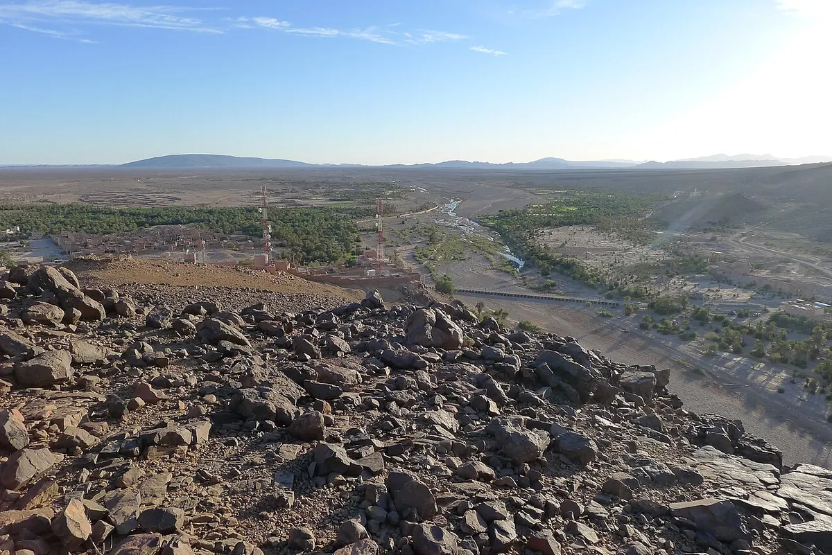
There is no fuel on the piste. On the eastern side, Zagora has several stations, some open around the clock, and Tagounite, about 30 km before M’hamid, has a couple more, according to OpenStreetMap. Forum reports say fuel in M’hamid itself has at times been sold from containers rather than a pump, so fill up in Zagora or Tagounite. On the western side, Foum Zguid has an Afriquia station at the west end of town.
Phone coverage is patchy once you leave the villages. Travellers report Maroc Telecom as the most reliable network in the south, yet even that drops out on parts of the piste and can be overloaded at the camps in the evening. Buy water, snacks and any cash you need before you leave M’hamid or Foum Zguid.
Without a car: buses, taxis and flights
You can get most of the way on public transport. As of November 2026, Rome2rio lists a Supratours bus from Marrakech to Zagora twice a day, taking about 7 hours, and shared taxis continue from Zagora to M’hamid. CTM has also run a direct bus to M’hamid, but timetables change, so check with the operators before you travel. Zagora has a small airport with very few scheduled flights, so check with Royal Air Maroc before you plan around it.
From M’hamid, the last stretch always needs a 4x4. Most camps include a transfer or can arrange one, and local agencies in M’hamid run Erg Chigaga tours from the village by 4x4 or camel. Foum Zguid has far less public transport, so it works best if you already have a car.
Plan your trip
- Read our main Erg Chigaga guide for the dunes, camps, weather and how many days to plan.
- Browse Erg Chigaga tours if you would rather have the driving, the piste and the camp handled for you.
- See the Mhamid Morocco guide for where to sleep and eat before the piste.
Frequently asked questions
How far is Erg Chigaga from Marrakech?
Erg Chigaga is 446 to 448 km of road from Marrakech to M'hamid, followed by 50 to 60 km of piste. The western approach is shorter on tarmac: about 311 to 317 km to Foum Zguid, then 60 to 100 km of track past Lake Iriki. Route planners give roughly 7 h 40 to 8 h 40 to M'hamid or 5 h to 5 h 45 to Foum Zguid, before the desert section and any stops.
How far is Erg Chigaga from Mhamid?
The first big dunes are about 50 to 60 km west of M'hamid El Ghizlane, and Wikipedia and Lonely Planet both give about 56 km to the centre of the erg. The whole distance is unpaved piste over stony hamada, soft sand and dry lake beds. Most 4x4 transfers take 1.5 to 3 hours, depending on the camp, the driver and how soft the sand is that week.
How long does it take to get to Erg Chigaga from Marrakech?
Allow a full day at the very least. Driving alone adds up to about 9.5 to 11.5 hours via M'hamid, or 8 to 9 hours via Foum Zguid, once you include the piste. With meals, photo stops and the slow Tizi n'Tichka pass, most people split the trip and sleep in Ouarzazate, the Drâa valley or Zagora on the way.
Can you drive to Erg Chigaga without a 4x4?
No. A normal car can reach M'hamid or Foum Zguid on tarmac, but the final section is an unmarked desert piste, and the Souss-Massa regional tourism board states that a 4x4 is mandatory. Soft sand stalls low cars and sharp stones cut tyres. The usual solution is to park in M'hamid or Foum Zguid and take a 4x4 transfer with a local driver.
Is it safe to drive from Mhamid to Erg Chigaga?
With a local driver, yes: it is a routine run for them. Driving it yourself is a different matter. Tracks split and fade, wind covers them, phone signal is patchy and help is far away if you break down. If you insist, use a high-clearance 4x4 with low range, carry recovery gear, spare fuel and plenty of water, and travel with a second vehicle or a guide.
How do you get to Erg Chigaga from Agadir?
The quickest way from Agadir is the western approach. Drive about 353 to 356 km east to Foum Zguid, which route planners put at roughly 4 h 50 to 5 h 30, then take a 4x4 across Lake Iriki to the dunes. Going via M'hamid is much longer, about 541 to 564 km of road, so it only makes sense as part of a wider loop through the Drâa valley.
Can you reach Erg Chigaga by public transport?
Only part of the way. Buses run from Marrakech and Ouarzazate to Zagora, and services and shared taxis continue to M'hamid, though timetables change often, so check with CTM or Supratours before you travel. Zagora also has a small airport, but it has very few scheduled flights, so check with Royal Air Maroc before you count on one. From M'hamid, your camp or a local agency has to drive you the last 50 to 60 km by 4x4.
Sources we checked
- Erg Chigaga (Wikipedia)
- M'Hamid El Ghizlane (Wikipedia)
- M'Hamid travel guide (Wikivoyage)
- Erg Chigaga, M'Hamid la dernière oasis (Lonely Planet France)
- Parc National d'Iriqui: traversée Foum Zguid - M'Hamid (Explore Agadir Souss Massa)
- Parc National d'Iriqui (Explore Agadir Souss Massa)
- Driving the off-road track from M'Hamid to Erg Chigaga (Dangerous Roads)
- Erg Chegaga, voyage au cœur du désert marocain (Le Petit Journal Maroc)
- Erg Chegaga desert guide (22places)
- Marrakesh to Mhamid (Rome2rio)
- Marrakesh to Foum Zguid (Rome2rio)
- Ouarzazate to Mhamid (Rome2rio)
- Ouarzazate to Foum Zguid (Rome2rio)
- Zagora to Mhamid (Rome2rio)
- Agadir to Foum Zguid (Rome2rio)
- Agadir to Mhamid (Rome2rio)
- Marrakesh to Foum Zguid transfer (Daytrip)
- OSRM route planner (OpenStreetMap data)
- Fuel stations south of Merzouga and on the M'hamid piste (Horizons Unlimited forum)
- Mobile internet in Morocco (camper.help)
- Zagora Airport (Wikipedia)
- Conseils aux voyageurs Maroc: sécurité (France Diplomatie)
Keep exploring
Related pages
 Erg ChigagaErg Chigaga guide: where it is, how high the dunes really are, the 4x4 piste from M'hamid, camp types, best months and how many days to plan.Read the guide
 Mhamid MoroccoMhamid Morocco guide: where the N9 ends, how to get there from Zagora or Marrakech, nearby dunes, the 4x4 piste to Erg Chigaga, weather and festivals.Read the guide
 Foum ZguidFoum Zguid guide: where it is, drive times from Agadir, Marrakech and Zagora, the piste to Erg Chigaga via Lake Iriki, fuel, souk day and weather by month.Read the guide
 Lake IrikiLake Iriki guide: the dry lake in Iriqui National Park, the 2024 floods, mirages, real wildlife odds, and the 4x4 piste from Foum Zguid to Erg Chigaga.Read the guide
 Ouarzazate to ZagoraOuarzazate to Zagora: 157 to 165 km on the N9 over the Tizi n'Tinififft pass, via Agdz and Tamnougalt. Drive times, photo stops, bus options.Read the guide