
Desert guide
Sahara desert Morocco: where the dunes are and how to reach them
Most of the Sahara desert Morocco shares with Algeria is flat stone and gravel, not sand. The big dune seas, called ergs, are few and far apart: Erg Chigaga beyond the village of M’hamid and Erg Chebbi at Merzouga are the two that matter for a trip, plus a handful of small dune fields near Zagora and M’hamid. Which one you pick, and how far it is from Marrakech, Agadir or Fes, decides how many days you need and what kind of desert you actually see.
Where is the Sahara desert in Morocco?
The Sahara covers about 9.2 million km² of North Africa, and Morocco holds a slice of its north-western edge. On the map, the Moroccan Sahara starts on the far side of the High Atlas and the Anti-Atlas. Cross the mountains from Marrakech and the land dries out fast: the valleys of the Drâa, the Dadès and the Ziz carry water and palm groves, and the plateaus between them turn into true desert. Most of it falls in the Drâa-Tafilalet region, along the closed border with Algeria.
Geographers often place the Sahara’s northern limit at the line where average rainfall drops below about 100 mm a year. The numbers show why Marrakech is outside it and Zagora is inside: Marrakech averages around 221 mm a year, Zagora about 61 mm. That is also why the stony hills of Agafay, the desert near Marrakech, are a pleasant day out but not part of the Sahara.
Erg, reg and hamada: three kinds of desert
Before you pick a trip, learn three words. They explain why one desert tour shows you rippling orange dunes and another shows you a gravel plain to the horizon.
| Word | What it means | Where you see it in Morocco |
|---|---|---|
| Erg | A sand sea: a large area of wind-blown sand, usually shaped into dunes | Erg Chigaga, Erg Chebbi, the small dune fields of Tinfou and Erg Lihoudi |
| Hamada | A high, bare plateau of rock where the wind has stripped the sand away | The plateaus around Merzouga and along the Drâa |
| Reg | A low, flat plain covered with gravel and pebbles, sometimes called desert pavement | The plains crossed by the tracks between M’hamid, Lake Iriki and Foum Zguid |
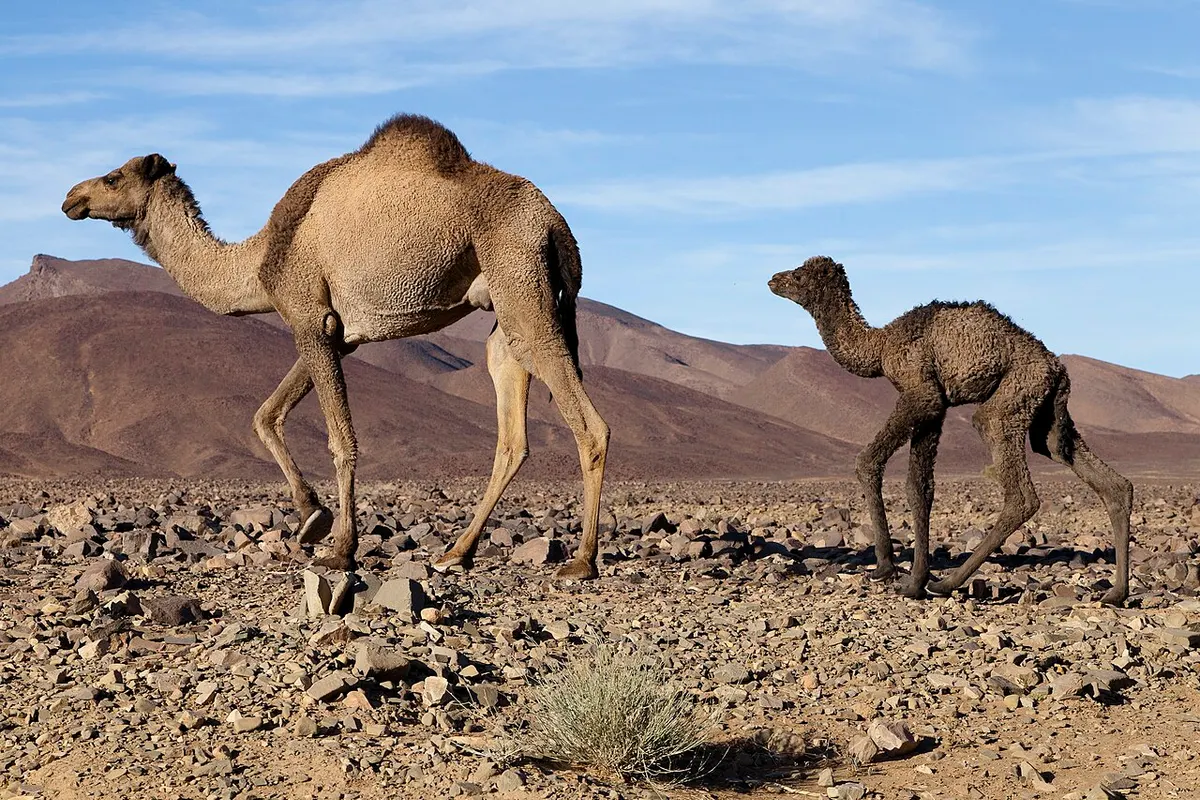
Sand dunes cover only about a fifth to a quarter of the whole Sahara, according to Britannica and the Danish encyclopedia Lex. Morocco follows the same pattern. You will spend far more time driving across hamada and reg than walking on sand, and that is normal. Those stony stretches are part of the trip, and on the piste to Erg Chigaga they are the reason the big dunes feel so remote when they finally appear.
Deserts in Morocco: where the real dunes are
Erg Chigaga
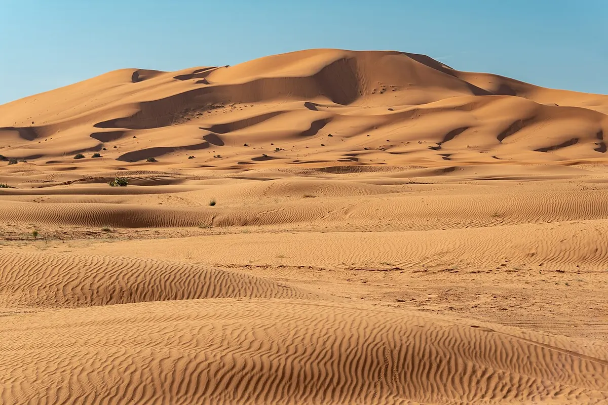
Erg Chigaga (also spelled Chegaga) lies about 50 to 60 km west of M’hamid El Ghizlane, the village where the paved N9 ends. No road reaches it. You get there by 4x4 across hamada, soft sand and dry lake beds, which takes roughly 1.5 to 3 hours depending on the track and the driver, or by camel over several days. It is generally described as the largest and wildest of Morocco’s ergs.
Published dune heights vary a lot. The Souss-Massa regional tourism board, Wikivoyage and Wikipedia put the tallest at about 50 to 60 m above the plain. Some websites quote more than 100 m and some tour sites claim 300 m, but we found no measurement that supports those higher figures. Stand at the foot of the highest ridge at sunset and the exact figure stops mattering. What sets Chigaga apart is the setting: camps are spread out, there is no village in sight, and the night sky has no town lights on the horizon. Read the full Erg Chigaga guide for camps, access and what to expect.
There are two ways in. From M’hamid, a 4x4 takes the eastern piste. From Foum Zguid, a track of about 60 to 100 km crosses the dry bed of Lake Iriki, inside Iriqui National Park (created in 1994), and takes around 2.5 to 3 hours. Many trips enter one way and leave the other. The details are in how to get to Erg Chigaga.
Erg Chebbi (Merzouga)
Erg Chebbi rises right behind the village of Merzouga, about 35 km south-east of Rissani in the Tafilalet. It is about 22 to 28 km long from north to south and 5 to 7 km wide, depending on the source, and its highest dunes reach about 150 m above the surrounding hamada. They are among the tallest dunes you can reach in Morocco without a 4x4.
The difference with Chigaga is access. A paved road runs all the way to Merzouga, and the first dunes start at the edge of town. That makes Erg Chebbi easy to visit, also by bus, and it explains why there are many more hotels and camps along its western side. You trade some solitude for comfort and a shorter last stretch. If you are torn between the two, the Erg Chebbi vs Erg Chigaga comparison sets them side by side.
Smaller dune fields: Tinfou, Erg Lihoudi and beyond
Between Zagora and M’hamid you pass several small patches of sand. The Tinfou dunes sit about 7 km south of Tamegroute, about 25 km south of Zagora on the N9. They are small, a cluster of dunes rather than a sand sea, but they work for a short camel ride if you only have a day or two. Zagora itself has palm groves and kasbahs but very little sand.
Erg Lihoudi (or Lehoudi) lies about 8 km from M’hamid, around 20 minutes by 4x4. Its dunes are much smaller than Chigaga’s but big enough for a sunset walk and a first night in a camp. Far beyond Chigaga, to the south-west, lie more remote dune fields such as Erg Ezahar and Erg Smar, which you only reach on multi-day camel treks with an experienced guide.
| Dune area | Gateway | Last stretch | Dunes | Busy or quiet |
|---|---|---|---|---|
| Erg Chigaga | M’hamid or Foum Zguid | 50 to 100 km of 4x4 track | Large erg, highest dunes about 50 to 60 m | Quiet, camps spread out |
| Erg Chebbi | Merzouga | Paved road to the edge of the dunes | Up to about 150 m | Busy, many camps and hotels |
| Erg Lihoudi | M’hamid | About 8 km of track | Small | Fairly quiet |
| Tinfou | Tamegroute, Zagora | Next to the N9 | Very small | Day visitors |
The Drâa valley route vs the Merzouga route
From Marrakech, both routes start the same way: the N9 climbs over the High Atlas by the Tizi n’Tichka pass, signposted at 2,260 m (a recent GPS reading put it slightly lower), then drops to Ouarzazate, 196 to 198 km from Marrakech. A short detour leads to the Ksar of Ait Benhaddou, a fortified earth village listed by UNESCO since 1987. After Ouarzazate the routes split.
The Drâa valley route to Erg Chigaga
South of Ouarzazate, the N9 crosses a range of bare hills and reaches Agdz, where the Drâa valley begins. The Drâa is Morocco’s longest river, at about 1,100 km, and its upper valley holds six sections of palm groves over about 200 km, from Agdz down to Zagora, Tamegroute, Tagounite and M’hamid. Ouarzazate to Zagora is 157 to 165 km, around 2 h 40 to 3 h of driving. Zagora to M’hamid adds about 95 km more. From M’hamid, the tarmac ends and the 4x4 track to Erg Chigaga begins. The Ouarzazate to Zagora route guide covers the stops on the way.
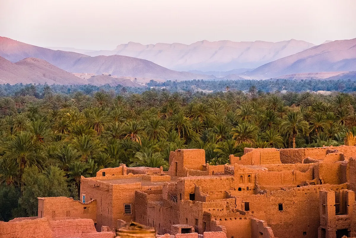
This route feels more like a journey: kasbahs, palm groves, then open desert. It is also shorter from Marrakech than Merzouga, and you can come back by a different road through Foum Zguid, which makes a loop.
The Merzouga route to Erg Chebbi
East of Ouarzazate, the road follows the Dadès valley to Tinghir, next to the Todra (Todgha) gorge, then crosses the desert plains to Erfoud and Rissani. Ouarzazate to Merzouga is about 355 to 360 km. From Marrakech the total is 534 to 560 km, around 8 h 30 to 10 h of driving without long stops. The canyons of the Dadès and the Todra, cut into the eastern High Atlas, are the main reason people choose this loop.
From Fes, Merzouga is closer: 456 to 461 km south through Ifrane, Midelt and Errachidia, roughly 7 h 15 to 8 h 10. That makes Merzouga the natural choice if you start in Fes or the north of Morocco.
| Drâa route (Erg Chigaga) | Merzouga route (Erg Chebbi) | |
|---|---|---|
| From Marrakech | 446 to 448 km to M’hamid, then 50 to 60 km of track | 534 to 560 km, paved all the way |
| Key stops | Ait Benhaddou, Ouarzazate, Agdz, Zagora | Ait Benhaddou, Ouarzazate, Dadès and Todra gorges, Rissani |
| Last stretch | 4x4 only | Normal car or bus |
| Best start city | Marrakech, Agadir | Fes, Marrakech |
| Feel | Remote, fewer visitors | Easy, more developed |
Gateway towns for the Moroccan Sahara
Six towns act as gateways to the Sahara desert Morocco visitors usually aim for. Ouarzazate is the hub of the south, with an airport and plenty of hotels. It is a good first night if you leave Marrakech late, and the starting point of both desert routes.
Zagora is the main town of the Drâa valley, 349 to 360 km from Marrakech. Many short tours stop here and call it “the desert”, but the town has little sand of its own. If you are deciding between a short trip and a longer one, read Zagora or Erg Chigaga.
M’hamid El Ghizlane is the last village at the end of the N9, and the usual starting point for 4x4 and camel trips to Erg Chigaga.
Foum Zguid is a small town on the western side of Iriqui National Park. It is the gateway to Erg Chigaga from Agadir and Taroudant, and the start of the track across Lake Iriki, a wide dry lake that can hold a few centimetres of water after rare autumn and winter rains, when migrating birds such as flamingos may stop there.
Tata sits further west, at the foot of the Jbel Bani on the southern side of the Anti-Atlas, about 137 km from Foum Zguid. It is a quiet base on the long southern road from Agadir and makes sense for travellers combining the Anti-Atlas with Erg Chigaga.
Merzouga, at the foot of Erg Chebbi, is the gateway to the eastern dunes, reached through Rissani and Erfoud.
Sahara desert Morocco: how many days from Marrakech, Agadir and Fes
The table below gives road distances and driving times from route planners (Rome2rio and OpenStreetMap routing), without stops. Real days are longer: mountain roads, photo stops, lunch and slow trucks easily add two hours. Our distance from Marrakech to the Sahara guide goes into more detail.
| From | To | Road distance | Driving time (no stops) |
|---|---|---|---|
| Marrakech | Ouarzazate | 196 to 198 km | 3 h 20 to just under 4 h |
| Marrakech | Zagora | 349 to 360 km | 6 h to 6 h 40 |
| Marrakech | M’hamid (for Erg Chigaga) | 446 to 448 km | 7 h 40 to 8 h 40 |
| Marrakech | Foum Zguid (for Erg Chigaga) | 311 to 317 km | 5 h to 5 h 45 |
| Marrakech | Merzouga | 534 to 560 km | 8 h 30 to 10 h |
| Agadir | Foum Zguid | 353 to 356 km | 4 h 50 to 5 h 30 |
| Agadir | Merzouga | about 650 km | about 10 h or more |
| Fes | Merzouga | 456 to 461 km | 7 h 15 to 8 h 10 |
From Marrakech, the honest minimum for real dunes is three days and two nights. That is the classic format of most Morocco desert tours from Marrakech, and it works for both Erg Chigaga and Merzouga, although the Merzouga version means two very long driving days. Four days lets you sleep a night in the Drâa valley or the Dadès gorges on the way and arrive in the dunes with energy left. A two-day Morocco desert trip from Marrakech only reaches the Zagora area and its small dunes. You can compare formats on our Marrakech desert tours page.
From Agadir, Erg Chigaga is the obvious target. You drive east to Foum Zguid in about five hours, then cross Lake Iriki by 4x4. Three days is the comfortable minimum; see the Agadir desert tours. Merzouga is too far for a short trip from Agadir.
From Fes, Merzouga is the closer erg. Three days covers Fes to Merzouga and back, or a one-way trip from Fes through the desert to Marrakech, which many travellers prefer because it avoids driving the same road twice.
What a night in a Morocco desert camp is like
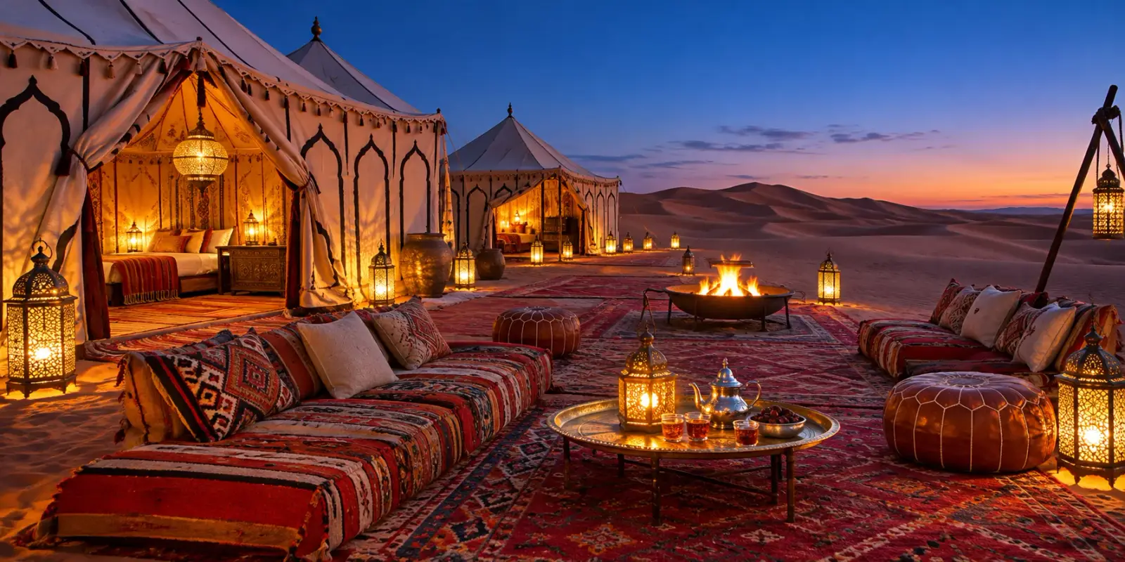
Most trips reach camp in the late afternoon. In Erg Chigaga you usually arrive by 4x4, sometimes with the last part on a camel. At Merzouga a Sahara desert camel ride into the dunes at sunset is the standard way in. Camps range from simple nomad-style tents with shared toilets to permanent luxury camps with real beds, private bathrooms and solar power. What each camp provides varies a lot, so ask before you book.
The routine is similar everywhere. You climb a dune for sunset, come back for mint tea, then dinner, often a tagine and soup, served in a tent or outside. Some camps light a fire and play drums afterwards. Later the generator or the lights go off. On a night without moon you can see the Milky Way from one horizon to the other, especially in Erg Chigaga, far from any town. Our guide to stargazing in the Moroccan desert explains when the sky is darkest.
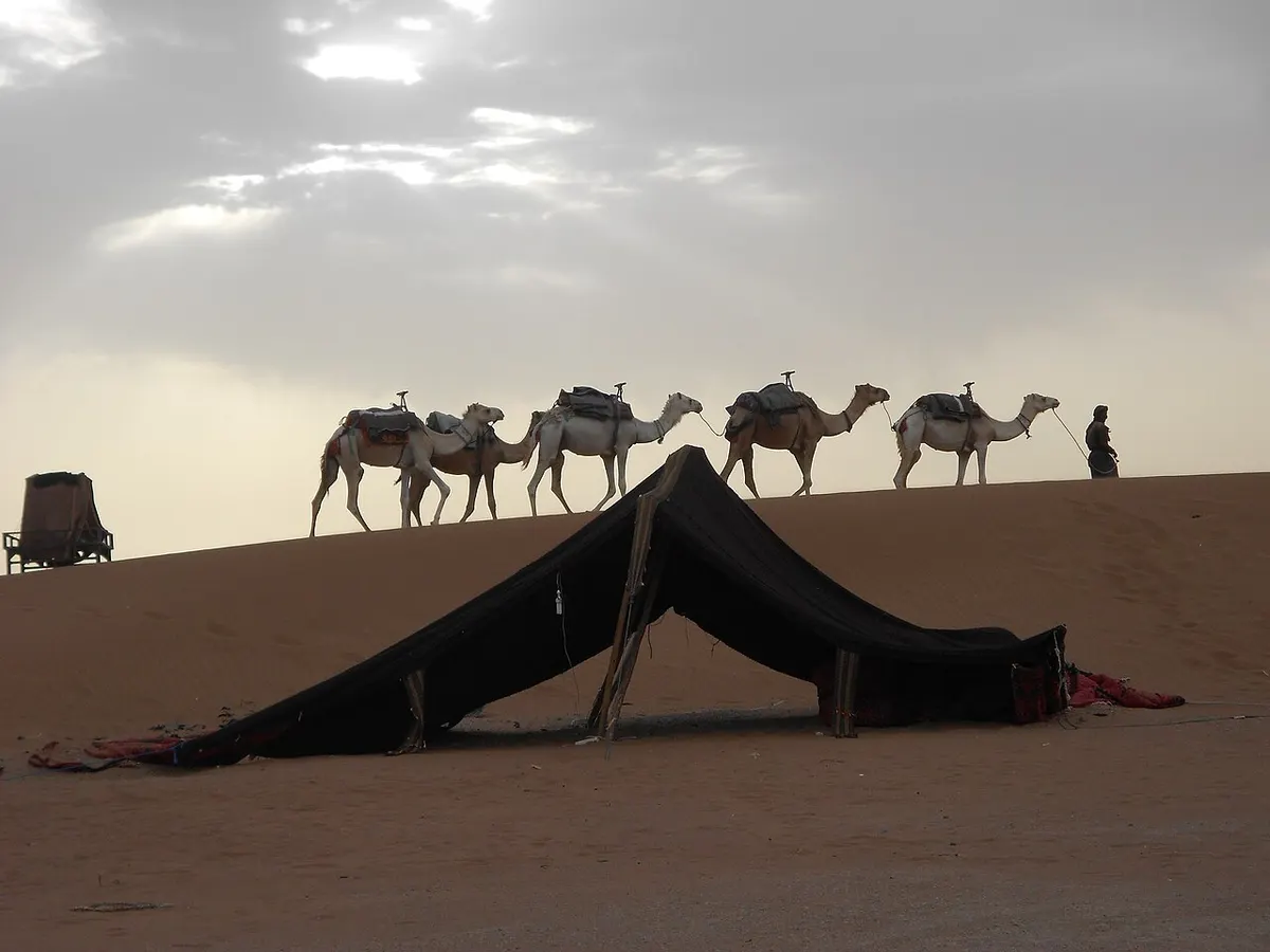
Nights in winter are cold. In Zagora the average January low is about 4°C, and on open sand it feels colder once the wind picks up. In summer the opposite happens: July nights stay around 25°C or more. Bring layers in any season and read what to wear in the Sahara desert before you pack. Sunrise comes early and is worth getting up for: the dunes are cool, the light is soft and the wind has usually not started yet.
For Sahara desert Morocco camping in comfort, a fixed camp is the easy choice. If you prefer moving through the desert, a camel trek in Morocco lets you sleep in a different place each night. Families should read our page on the Morocco desert with kids, and anyone who wants a private tent in Erg Chigaga can look at the Erg Chigaga luxury desert camp.
When to go
The Moroccan desert has two comfortable seasons, autumn and spring, and one harsh one. These monthly averages for Zagora give a fair idea of the Drâa valley. Open desert can be a little hotter by day and colder at night.
| Month | Average high | Average low | Rain |
|---|---|---|---|
| January | about 19-20°C | about 4°C | about 4 mm |
| April | about 31°C | about 13°C | about 1 mm |
| July | about 42-45°C | about 25-27°C | about 1 mm |
| October | about 31°C | about 15°C | about 13 mm |
Figures from climate-data.org (via Wikipedia) and WeatherSpark, rounded. Summer trips are possible if you stay in the shade from late morning to late afternoon, but they are tiring. The month-by-month breakdown is in the best time to visit the Sahara desert in Morocco.
Is the Sahara desert in Morocco safe?
Desert trips in Morocco run on well-used routes, but a few points are worth knowing before you go. The land border with Algeria is closed, and the UK government warns that crossing it without authorisation is illegal (as of November 2026). France’s travel advice classes the zone along the southern part of that border as an area of “heightened vigilance”, and it advises against driving at night on Moroccan roads. Erg Chigaga and Erg Chebbi are both close to that border, so stay on known routes with a local driver or guide, and do not drive the pistes alone in an ordinary car. Our page on whether the Sahara desert in Morocco is safe covers health, driving and solo travel.
Plan your Sahara trip
To build the Sahara desert Morocco trip that suits you, pick your dunes first, then your route and the number of days. These pages cover each step:
- Destinations: Erg Chigaga, M’hamid, Zagora, Foum Zguid, Lake Iriki, Tata and the Agafay desert near Marrakech.
- Comparisons: Erg Chebbi vs Erg Chigaga and Zagora or Erg Chigaga.
- Practical guides: how to get to Erg Chigaga, Ouarzazate to Zagora, distance from Marrakech to the Sahara desert, best time to visit, what to wear, safety, stargazing and travelling with kids.
- Tours: Erg Chigaga tours, Marrakech desert tours, Agadir desert tours and camel treks.
Frequently asked questions
Where is the Sahara desert in Morocco?
The Moroccan Sahara lies south and east of the High Atlas and Anti-Atlas mountains, mainly in the Drâa-Tafilalet region along the Algerian border. Most of it is stony plateau and gravel plain. The two big sand seas visitors travel to are Erg Chigaga, about 50 to 60 km west of M'hamid at the end of the Drâa valley, and Erg Chebbi, which starts at the edge of Merzouga village in the Tafilalet.
How far is the Sahara desert from Marrakech?
It depends on which dunes you mean. Route planners give 446 to 448 km to M'hamid, the last village before Erg Chigaga, then another 50 to 60 km of 4x4 track. Merzouga and Erg Chebbi are 534 to 560 km away on paved roads. Both drives cross the High Atlas by the Tizi n'Tichka pass and take a full day or more, so most trips split the drive with a night on the way.
What is the desert in Morocco called?
It is the Sahara, the desert that covers much of North Africa. Moroccans and guides usually name the specific part they mean: an erg is a sand sea, such as Erg Chigaga or Erg Chebbi, while a hamada is a stony plateau and a reg is a gravel plain. The small stony desert near Marrakech has its own name too, Agafay, but it lies outside the Sahara.
Which is better, Erg Chigaga or Erg Chebbi?
Neither is better for everyone. Erg Chebbi at Merzouga is reached on tarmac, has the tallest single dunes and many camps, so it suits people who want an easy, comfortable night. Erg Chigaga needs a 4x4 trip across open desert from M'hamid or Foum Zguid, is quieter and feels more remote, and is the closer of the two to Marrakech and Agadir.
How many days do you need to see the Sahara from Marrakech?
Plan at least three days and two nights for Erg Chigaga or Merzouga, because each is a full day's drive from Marrakech in each direction. Four days gives you time for the Drâa valley, Ait Benhaddou or the Dadès and Todra gorges without spending every daylight hour in the car. A two-day trip only reaches the small dunes around Zagora.
Is Agafay part of the Sahara?
No. Agafay is a stony semi-desert about 30 to 40 km south-west of Marrakech, on the north side of the High Atlas. Marrakech gets about 221 mm of rain a year on average, more than double the roughly 100 mm line usually used as the Sahara's northern limit. Agafay is a fine short escape, but it has no big sand dunes.
Can you visit the Sahara from Agadir?
Yes. The most direct option from Agadir is the road east through the Souss valley to Foum Zguid, 353 to 356 km and 4 h 50 to 5 h 30 of driving, followed by about 60 to 100 km of track across the dry Lake Iriki to Erg Chigaga. Merzouga is about 650 km from Agadir, which is too far for a short trip unless you fly or add several days.
When is the best time to visit the Sahara in Morocco?
October, November, March and April are the easiest months, with warm days and cool nights. December to February brings mild days and cold nights: in Zagora the average January low is about 4°C, and open dunes feel colder. From June to early September average highs in Zagora pass 37°C and July averages about 42 to 45°C, which makes desert trips hard work.
Sources we checked
- Sahara (Wikipedia)
- Erg (landform) (Wikipedia)
- Hamada (Wikipedia)
- Erg Chebbi (Wikipedia)
- Erg Chigaga (Wikipedia)
- M'Hamid El Ghizlane (Wikipedia)
- M'Hamid travel guide (Wikivoyage)
- Merzouga (Wikipedia)
- Draa River (Wikipedia)
- Tizi n'Tichka (Wikipedia)
- Ait Benhaddou (Wikipedia)
- Parc national d'Iriqui, traversée Foum Zguid - M'hamid (Explore Agadir Souss Massa)
- Driving the off-road track from M'Hamid to Erg Chigaga (Dangerous Roads)
- Zagora climate (Wikipedia, climate-data.org figures)
- Average weather in Zagora (WeatherSpark)
- Marrakesh climate (Wikipedia, NOAA normals)
- Marrakesh to Merzouga (Rome2rio)
- Agadir to Foum Zguid (Rome2rio)
- Marrakesh to Foum Zguid (Rome2rio)
- Fes to Merzouga (Rome2rio)
- Morocco travel advice: regional risks (GOV.UK)
- Conseils aux voyageurs : Maroc (France Diplomatie)
Keep exploring
Related pages
 Erg ChigagaErg Chigaga guide: where it is, how high the dunes really are, the 4x4 piste from M'hamid, camp types, best months and how many days to plan.Read the guide
 Erg Chebbi vs Erg ChigagaErg Chebbi vs Erg Chigaga, compared honestly: access, drive times from Marrakech and Fes, dune height, crowds, camps and who each desert suits.Read the guide
 Distance from Marrakech to Sahara desert campsDistance from Marrakech to Sahara desert dunes: Zagora 350 km, Erg Chigaga about 500 km, Merzouga 534 to 560 km. Drive times, Tichka pass, buses, flights.Read the guide
 Best time to visit Sahara desert MoroccoThe best time to visit Sahara desert Morocco is October to November and February to April. Month-by-month temperatures, wind, Ramadan 2027, festivals.Read the guide
 Agafay desert MoroccoAgafay desert Morocco: a stony semi-desert 30 to 40 km from Marrakech, not the Sahara. Distance, camps, what to do, and when Erg Chigaga is a better pick.Read the guide
 Is the Sahara desert in Morocco? Yes, and this is where it startsIs the Sahara desert in Morocco? Yes, in the south-east. A map table of the ergs, hamada, Agafay and Western Sahara, plus drive times from Marrakech.Read the guide
 Where to stay in Sahara desert MoroccoWhere to stay in Sahara desert Morocco: Merzouga, M'hamid, Erg Chigaga camps, Zagora, Foum Zguid or Agafay, hotel types and what to check before booking.Read the guide
 Movies filmed in OuarzazateMovies filmed in Ouarzazate, checked title by title: Gladiator, Game of Thrones, The Odyssey and more, plus how to visit Atlas, CLA and the cinema museum.Read the guide