
Destination guide
Lake Iriki: the dry lake between Foum Zguid and Erg Chigaga
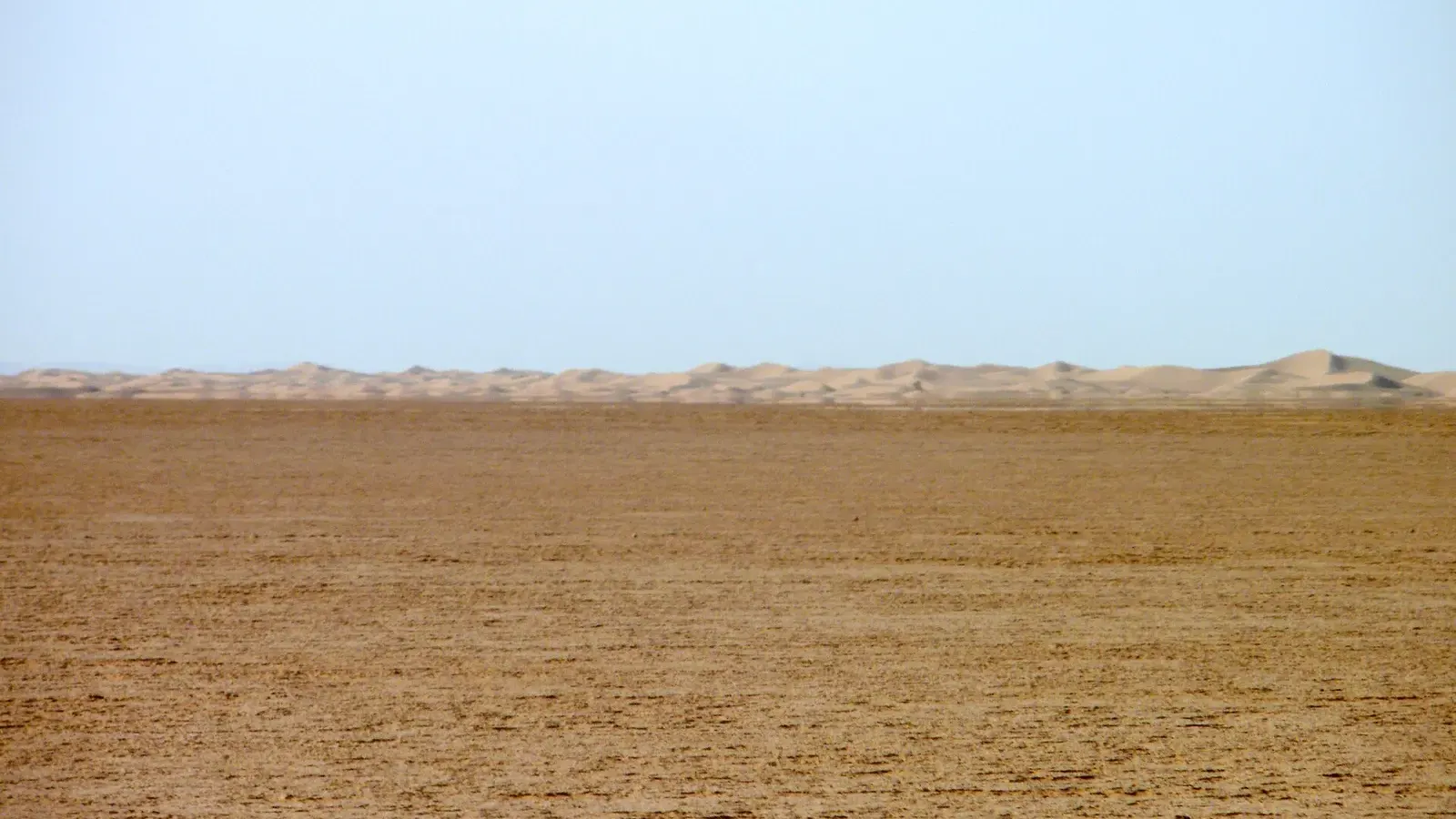
Photo: Angela Stefanoni, CC BY 3.0, via Wikimedia Commons (Panoramio)
Lake Iriki is a huge, usually bone-dry lake bed in southern Morocco, the flat centre of Iriqui National Park between the oasis of Foum Zguid and the dunes of Erg Chigaga. Most years there is no water at all, just cracked clay, heat shimmer and the tyre tracks of 4x4s heading for the dunes. Then, in September 2024, two storms filled it, its first notable filling in about 50 years.
Where is Lake Iriki?
The lake bed lies south of the Jbel Bani ridge, roughly 40 to 50 km south-east of Foum Zguid as the piste runs, and west of the Erg Chigaga dunes. On OpenStreetMap the mapped bed measures about 13 km north to south and about 10 km east to west, centred near 29.82° N, 6.50° W. It falls within Tata province (Souss-Massa region), while the park around it spills east into Zagora province.
There is no road. You reach it on the desert piste from Foum Zguid in the west, or across the dunes from M’hamid in the east. South of the park the land runs on towards the Algerian border, which is closed.
Iriqui National Park in brief
Iriqui National Park was created in 1994 and covers about 123,000 hectares (1,230 km²), between the dry bed of the Drâa and the southern slopes of the Anti-Atlas. According to the Souss-Massa regional tourism board, one of its main goals was to restore the temporary wetland of Lake Iriqui at its centre, and sand dunes cover about half of its surface. The rest is stony hamada, wooded steppe and acacia savanna, with tamarisk on some of the dunes.
The park is listed as IUCN category II (national park) and is run by Morocco’s water and forests administration. A few families still live inside it and graze livestock, so do not be surprised to pass a tent, a well or a herd of goats.
Most of the big dunes of Erg Chigaga lie inside the park’s eastern half. In practice, that means a classic desert crossing from Foum Zguid to M’hamid spends most of its day inside Iriqui.
Lake Iriki, Iriqui or Iriqi? The spellings
The name was written down from Arabic (إيريكي) and Tamazight, and nobody agreed on a single Latin spelling. Iriqui is the form used for the national park. Iriki is the one you will see most on maps, road signs and tour programmes for the lake itself. Iriqi turns up less often. French speakers write lac Iriki or lac Iriqui.
They all mean the same place. If you are searching for photos, maps or recent conditions, try all three spellings.
September 2024: the year the lake came back
On 7 and 8 September 2024 an extratropical storm crossed the north-western Sahara and dropped heavy rain on parts of Morocco and Algeria. NASA’s Earth Observatory then published a satellite image, taken on 10 September, that showed a new sheet of water in Iriqui National Park. Its preliminary rainfall estimates ranged from many tens to more than 200 mm in the affected areas, roughly what the region normally gets in a whole year.
Morocco’s national weather service told reporters that the lake had been dry for about half a century. Researchers who studied the event confirm the order of magnitude:
- A study published in the journal Land in January 2025 (Moumane and colleagues) tracked the lake with Landsat and Sentinel-2 images. Surface water grew from nothing to more than 80 km² after the first storm and to about 146 km² after a second one later in September. Its field teams recorded migratory birds back on the lake, which they say had last been seen there in 1968.
- The satellite company Brockmann Consult found the lake dry in every Landsat image since 1972, and mapped about 81 km² of water within a month of the first storm. It still showed water in images from 3 and 9 October 2024.
The figures differ slightly because the studies used different images and dates. Both describe the same event, the first real flooding of the lake in roughly fifty years.
Is there water in Lake Iriki now?
Probably not. The 2024 water evaporated over the following months, and local operators who cross the pan report it dry again in 2025 and 2026, back to the hard clay surface 4x4s use as a shortcut (as of November 2026). The regional tourism board describes the normal state of the lake as dry, with at most a few centimetres of water during rainy periods.
Because a single storm can change things, ask a local driver or your camp about the lake before you set off, especially between October and March. Wet clay is the main hazard here, more than water.
Lake Iriki mirage and the dry lake bed
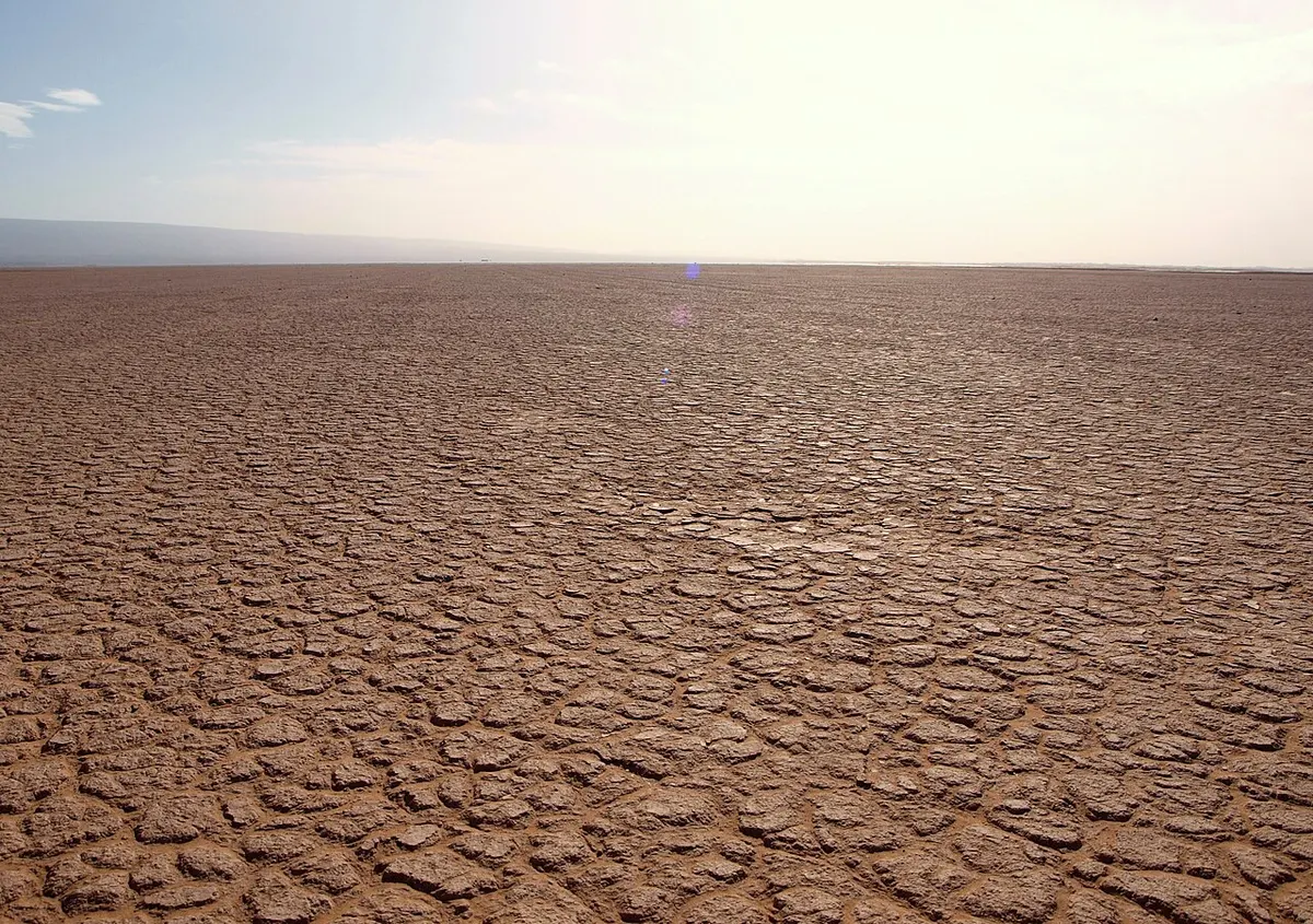
What stays with most people after Lake Iriki is how flat it is. After the bumpy hamada, the 4x4 rolls onto a surface so smooth and level that the horizon disappears into haze. On a hot day the far edge of the pan shimmers and seems to hold water. That is a mirage: hot air just above the ground bends light from the sky, and your brain reads the blue patch as a lake. It vanishes as you drive towards it.
Many drivers stop in the middle for photos, because nothing blocks the view in any direction. Where the clay has dried after rain, it cracks into tiles like the ones in the photo above.
Wildlife in Iriqui National Park
The species list for Iriqui is longer than what you are likely to see. Official and encyclopedic sources name dorcas gazelles, Barbary sheep, striped hyenas, houbara bustards and North African ostriches, plus lizards, horned vipers, monitor lizards, chameleons and snakes. Several of these are rare, nocturnal or kept away from the main tracks.
Reintroduction work has added animals in recent years. In June 2026, Moroccan press reports citing the national forestry agency (ANEF) put the park’s dorcas gazelle population at more than 450, up from about 20 in 2018 after more than 200 were released, and counted 55 to 60 addax living wild after releases that began around 2019 and 2020. The regional tourism board also lists oryx and red-necked ostrich among the species planned for reintroduction.
So what will you actually see? On a typical crossing, small desert birds, lizard tracks in the sand, grazing livestock (camels included), and with luck a gazelle in the distance. Flamingos, coots and geese only stop on the lake in the rare years when it holds water, mostly in winter. Treat any big-animal sighting as a bonus.
Foum Zguid to Lake Iriki and on to Erg Chigaga
The track leaves the tarmac just south of Foum Zguid. The regional tourism board describes a stony piste running past Jbel Madouer Kbir and Jbel Madouer Sghir towards the lake, and lists a 4x4 as mandatory. These are the usual stages:
| Stage | Distance (approx.) | Time in a 4x4 | Ground |
|---|---|---|---|
| Foum Zguid to the western edge of Lake Iriki | 40 to 50 km | about 1 h | stony hamada, corrugations |
| Across the lake bed | 10 to 13 km | 15 to 30 min | hard clay when dry |
| Lake Iriki to the Erg Chigaga camps | 20 to 50 km | 1 to 2 h | sand, tamarisk, low dunes |
| Full Foum Zguid to Erg Chigaga | 60 to 100 km | 2.5 to 3 h (up to 3.5 h with a stop at the lake) | all of the above |
| Full crossing Foum Zguid to M’hamid | about 110 to 160 km | 5 to 6 h of driving | all of the above, then hamada east of the dunes |
Distances vary because there is no single track, and every driver has a favourite line. For the full picture, including the M’hamid side and self-driving, read our guide on how to get to Erg Chigaga.
After rain the picture changes. The tourism board warns that after wet months (October, November and December) the clay can become a trap, and drivers switch to tracks around the rim of the lake, which adds time. Never drive onto a damp pan without someone who knows it.
Can you camp at Lake Iriki?
There are a few small auberges and café-stops along the tracks around the lake, and most Lake Iriki desert camp searches really lead to the camps in the Erg Chigaga dunes further east. Sleeping in the dunes is the usual choice. Wild camping on the bare lake bed itself has no shelter from wind and is a poor idea after rain.
Park rules and safety
As of November 2026, the official tourism pages for Iriqui National Park do not mention an entry fee or permit, and operators report no gate on the Foum Zguid piste. That does not make it a free-for-all. The park is a protected area, and the basics are simple: keep to existing tracks, do not chase or feed animals, do not collect plants or stones, and take every scrap of rubbish out with you.
Safety comes down to remoteness. There is little or no phone signal, no fuel between Foum Zguid and M’hamid, and summer heat is extreme. The Algerian border to the south is closed (GOV.UK says not to attempt to cross it), and the French foreign ministry places the area along the southern border with Algeria in its “vigilance renforcée” category. Stay on the known pistes with a local driver. Our page on whether the Sahara desert in Morocco is safe goes into more detail.
Iriqui National Park: best time to visit
| Season | What to expect |
|---|---|
| October to November | Warm days, cooler nights. Check the lake after any autumn storm. |
| December to February | Mild days around 19 to 21°C, cold nights near 5°C. Best chance of water and birds in a wet year. |
| March to April | Warm, settled, usually dry. A very good window for the crossing. |
| May to September | Hot to very hot, with July highs around 42°C nearby. Start at dawn or avoid. |
Temperatures are for nearby Foum Zguid (ERA5 averages, 2005 to 2024); the open plain can feel hotter at midday.
Plan your crossing
Few people visit Lake Iriki on its own. It is the middle section of the western desert crossing, and that is how most travellers see it. For organised trips, see the Erg Chigaga tours page, or the Agadir desert tours page if you are starting from the coast. If you are building your own trip, start with the Foum Zguid guide and the Tata Morocco guide for the oasis road to the west.
Frequently asked questions
Is there water in Lake Iriki?
Most of the time, no. Lake Iriki is a dry clay pan for years on end. In September 2024 two rare storms flooded it, and satellite data showed up to about 146 km² of water after the second storm. Operators who cross it say it was dry again by 2025, as it usually is. A thin sheet of water can still appear after heavy winter rain, so ask a local driver about current conditions.
How do you get to Lake Iriki?
The usual start is Foum Zguid, in Tata province, where the tarmac ends. From there a 4x4 piste crosses about 40 to 50 km of stony plain to the western edge of the lake, roughly an hour's drive when the ground is dry. You can also reach it from M'hamid by crossing Erg Chigaga from the east. There is no paved road and a 4x4 with a driver who knows the tracks is the safe way to go.
Is it Lake Iriki or Lake Iriqui?
Both, and a few more. The name comes from Arabic and Tamazight and has no fixed Latin spelling. The national park is usually written Iriqui, while maps and tour operators often write Iriki for the lake. You will also see Iriqi, and in French lac Iriki or lac Iriqui. All of them refer to the same dry lake and the same protected area.
Can you see wildlife at Lake Iriki?
Sometimes, but do not plan around it. The park's species list includes dorcas gazelles, Barbary sheep, striped hyenas and houbara bustards, and reintroduction programmes have released dorcas gazelles and addax. Most of these animals are shy and widely spread, so a crossing usually shows you birds, lizards and tracks rather than large mammals. Waterbirds such as flamingos appear only in the rare years when the lake holds water.
Do you need a permit to visit Iriqui National Park?
None of the official tourism pages for Iriqui National Park mention an entry ticket or permit, and operators report no gate on the piste (as of November 2026). It is still a protected area, so stay on existing tracks, take all rubbish out with you and leave plants, stones and animals alone. Rules can change, so a local guide is the best way to check before you go.
What is the best time to visit Lake Iriki?
October to April is the comfortable season, with daytime temperatures that make a long 4x4 day bearable. Winter nights are cold, often around 5°C. From June to September midday heat passes 40°C on the plain. Be careful after rain in autumn and winter: the regional tourism board warns that the clay bed can turn to mud that traps vehicles.
Sources we checked
- Iriqui National Park (Wikipedia)
- Aux portes du désert: le Parc National d'Iriqui (Explore Agadir Souss Massa, regional tourism board)
- Parc National d'Iriqui: traversée Foum Zguid - M'Hamid (Explore Agadir Souss Massa)
- Iriqui National Park (Mori Atlas)
- A Deluge for the Sahara (NASA Earth Observatory, September 2024)
- Lake Iriqui's Remarkable Revival (Moumane et al., Land, January 2025)
- Lake Iriqui water-filled for the first time in the satellite record (Brockmann Consult)
- Morocco: rare floods in the desert regions (Africanews, October 2024)
- In half a century, rare Saharan floods fill dry lake beds in Morocco (Morocco World News, October 2024)
- Addax, gazelles, oryx: le Maroc restaure sa faune sauvage (Médias24, June 2026)
- Lac Iriki and Parc National d'Iriqui map data (OpenStreetMap)
- Lake Iriqui guide (Desert Foum Zguid, local operator)
- Maroc: conseils aux voyageurs, sécurité (France Diplomatie)
- Morocco travel advice: regional risks (GOV.UK)
Keep exploring
Related pages
 Foum ZguidFoum Zguid guide: where it is, drive times from Agadir, Marrakech and Zagora, the piste to Erg Chigaga via Lake Iriki, fuel, souk day and weather by month.Read the guide
 Erg ChigagaErg Chigaga guide: where it is, how high the dunes really are, the 4x4 piste from M'hamid, camp types, best months and how many days to plan.Read the guide
 How to get to Erg ChigagaHow to get to Erg Chigaga: the M'hamid and Foum Zguid pistes, drive times from Marrakech, Ouarzazate, Zagora and Agadir, and the truth about self-driving.Read the guide
 Mhamid MoroccoMhamid Morocco guide: where the N9 ends, how to get there from Zagora or Marrakech, nearby dunes, the 4x4 piste to Erg Chigaga, weather and festivals.Read the guide
 Tata MoroccoTata Morocco guide: the oasis town and province, Akka's rock engravings, ksour, the N12 to Foum Zguid, distances, weather, and why it isn't a dune stop.Read the guide